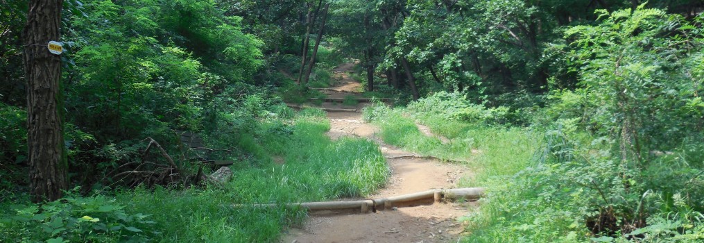
Craving a bit of peace and quiet and countryside after 3 weeks of Anyang’s unrelenting urbanism (see first post), on Sunday I strapped on my super Asolo hiking boots (thanks big sister!), packed a small backpack of provisions (waterproof, kiwi fruit, water), and walked uphill the half mile or so to the entrance of the mountain trail. The city’s relentless apartment blocks continued up the incline, eventually giving way to a path through fields of smallholdings growing chilli-peppers, yellow courgettes and hot-housed tomatoes, before these too gave way to pine forest.
The path was well-signposted and, despite the weather predicting thunderstorms, fairly busy with hikers. I’d read about how much Koreans are into hiking, and especially into hiking gear. So at first I was slightly amused by the layers of sweatproof, waterproof, neon clothing; the retractable trekking poles; the giant stuffed backpacks and GLOVES everywhere.
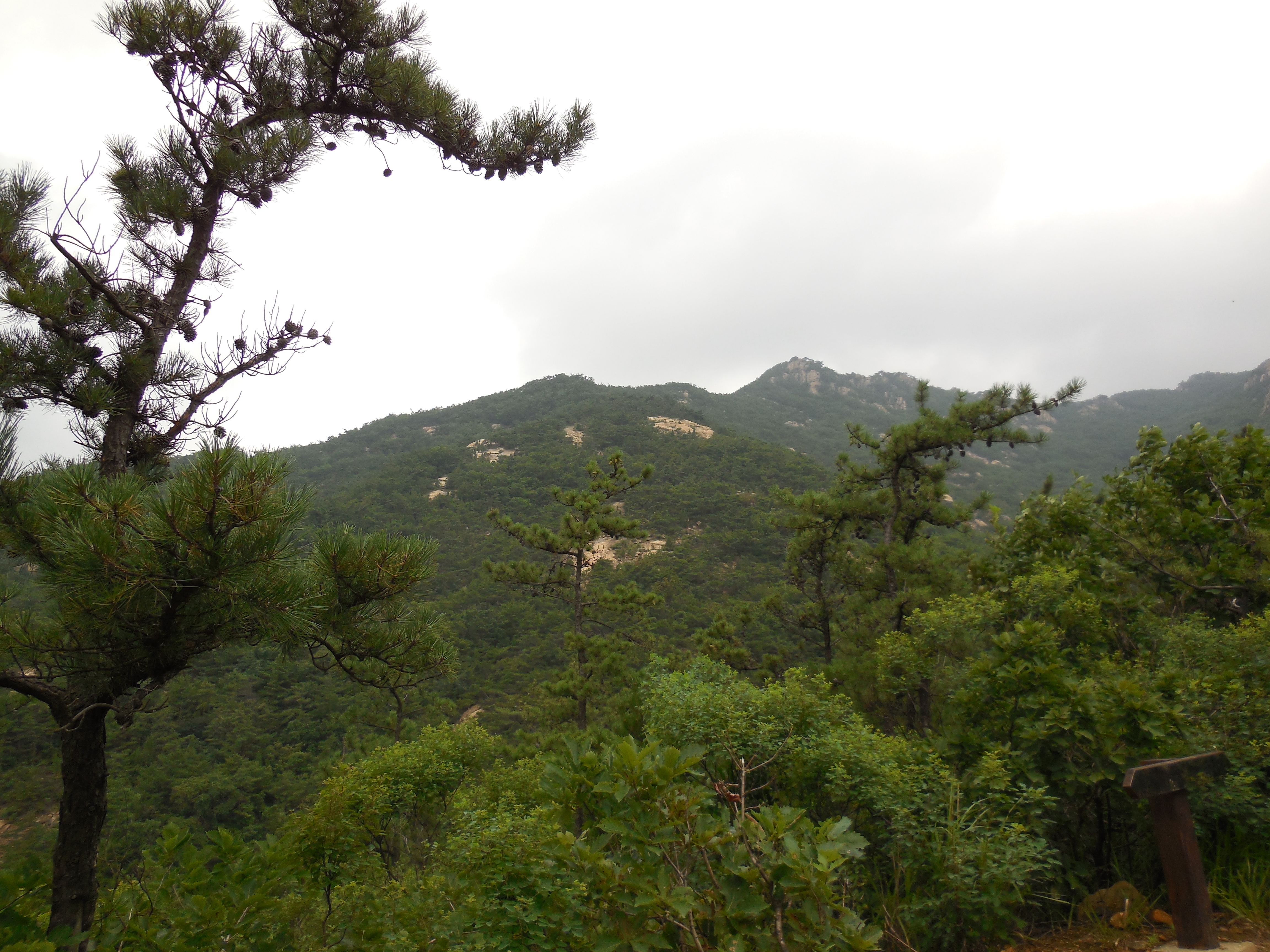
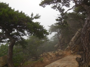
Moving uphill, the cover of the pine trees was occasionally left behind to reveal scenes like this, stunted pines jostling with young deciduous trees and low shrubs:
Soon it became apparent why so many people had so much gear. As it rose more steeply the path began to be broken up by rocky outcrops and groups of boulders.
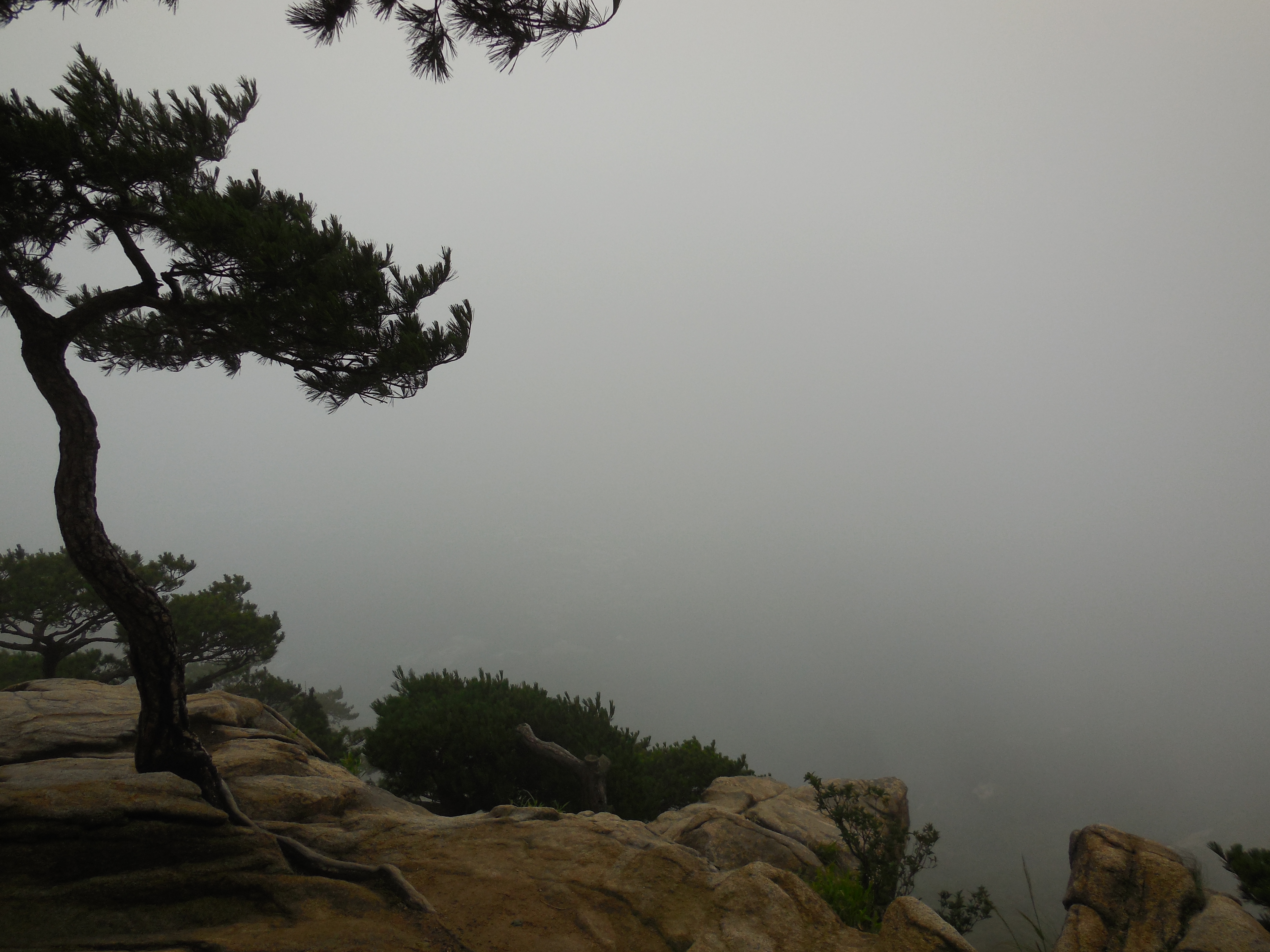
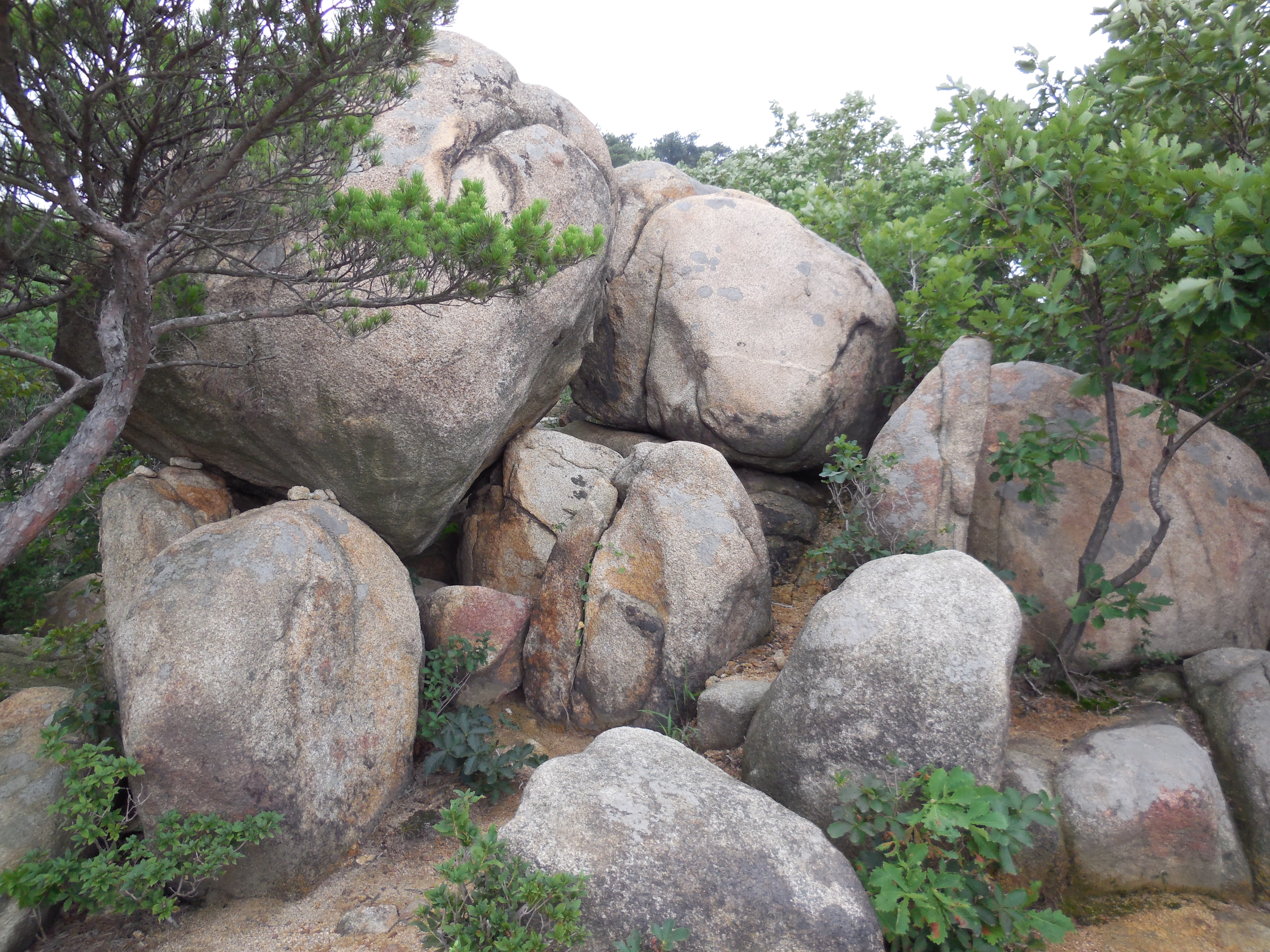 A comfortably beyond middle-aged couple passed me we with a cheery ‘Annyeong haseyo!‘, then proceeded to climb straight up a sheer rock cliff face (with trekking poles retracted to a useful length), chatting the entire time. Coming up these boulders by an easier path, I found views like this:
Rising still further, the visibility declined and the temperature noticeably dropped – or perhaps my raging hangover was finally easing. The path became a bit more difficult and I had to use my hands to scrabble up more than once (though one guy coming the other way in flip flops didn’t seem to have any problems). It was nicely challenging for a Sunday without being too difficult. The only slightly hairy section was when I couldn’t work out where the path led over one rocky outcrop, so I followed two Korean guys in vests and spiked shoes up a rock. After going a little way one of them turned and realised I was following somewhat gingerly behind. He stopped, holding one on to a rock with one hand, and with the other pointing back where I had come from, shouted ‘Jeogi!’ (저기 – ‘There!’). At this point I turned and realised I was almost-semi-dangling over a direct 2 or 300 feet drop… sheepishly I made my way back and waited for a mother and her 12 year-old daughter to come up the path so I could follow them on the route best suited to my ability…
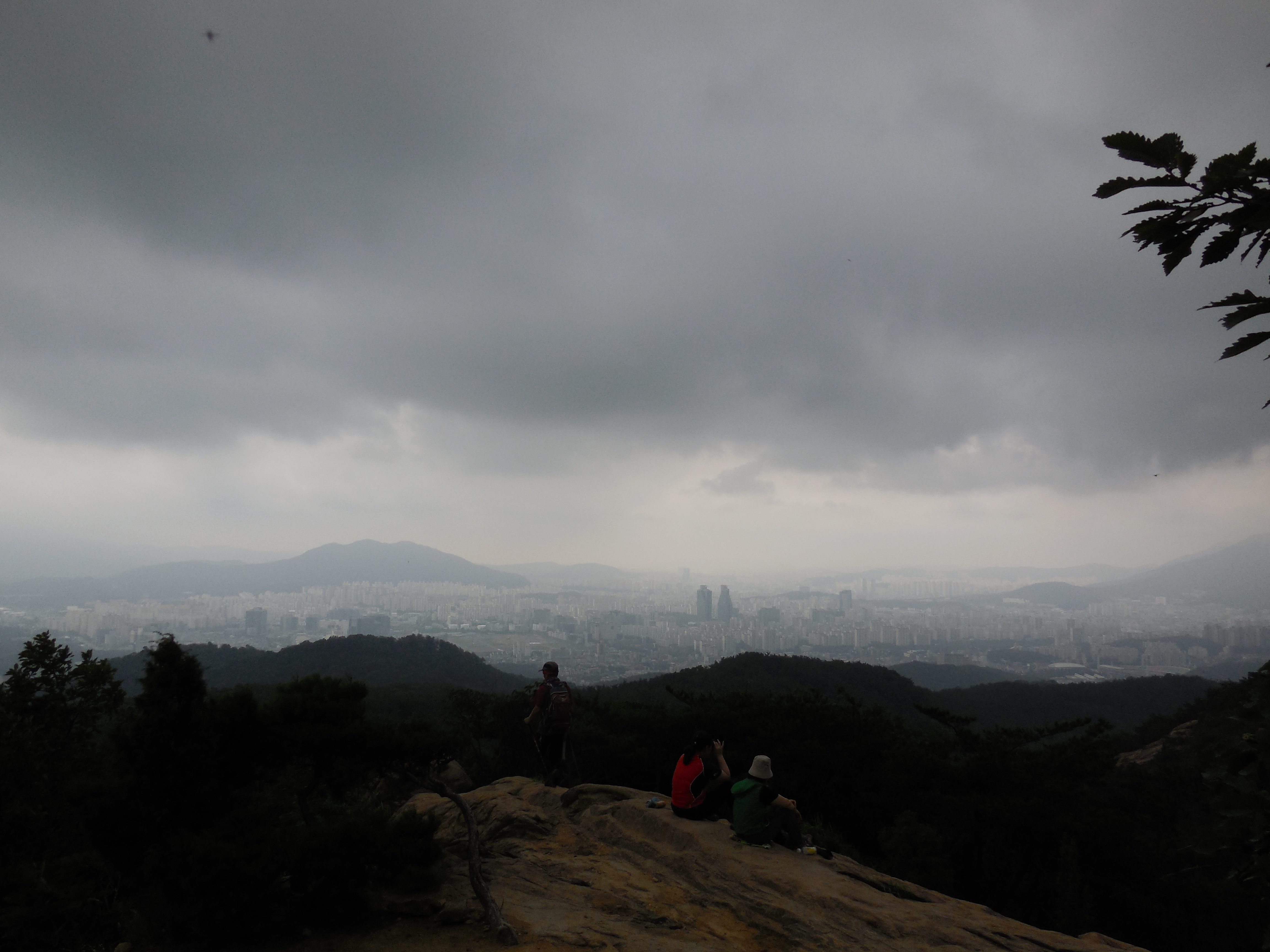
Finally, after about 1 1/2 hours I made it to the summit. I knew it was the top because there was a Korean flag and a man trying to be a lightning conductor:
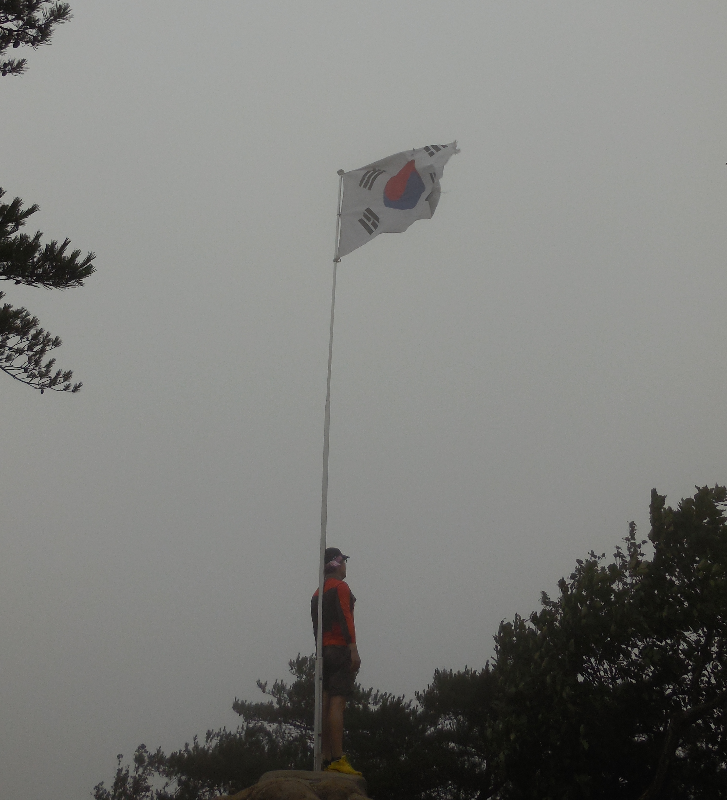
The climbing guys were up already and said hello and gave me a smile. The mother and daughter took out a mat to sit out and began to eat their lunch, staring out into the void. I thought I saw a small cat up there, but by the time I took out my camera it had disappeared… It was windy up there, and the visibility was near zero. There was a nicely mysterious quality in seeing nothing, like looking into a Chinese (or Japanese, or Korean) scroll painting.
Must try this hike again on a clear day.
I got back tired, (but with hangover defeated) and cooked myself a pork stir fry with fried rice in celebration. A pretty good Sunday outing.
Only later did I do some research and found that the main summit of Gwanaksan is actually called ‘Yeonju-dae’, home to a spectacular Buddhist temple, a radio tower, and possibly some cool Korean war era bunkers. Where had I reached then? I also learned that the mountain possesses a fire spirit, possibly responsible for the burning of a royal palace in Seoul and the 16th Century Japanese invasions. So that’s a challenge for another day…

Pingback: Korean Summer | Korea Change